The hill remembers. We’re listening.
Delve into the deep history, folklore, and everyday lives of the people who have lived beneath Shropshire’s iconic Wrekin hill for millennia. Watch our engaging videos and animations to uncover authentic stories from the past.
The Wreocensæte
(Old English: Wrēocensǣte, Wrōcensǣte, Wrōcesǣte, Wōcensǣte), anglicised as the Wrekinsets, were one of the peoples of Anglo-Saxon Britain. Their name approximates to "Wrekin-dwellers".
The Wrekin
(/ˈriːkɪn/ REE-kin)
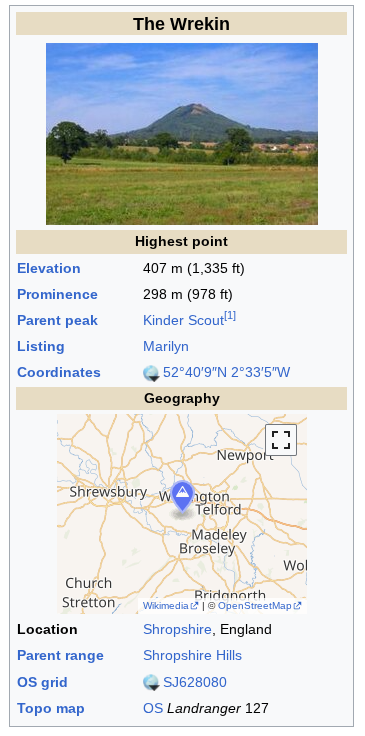
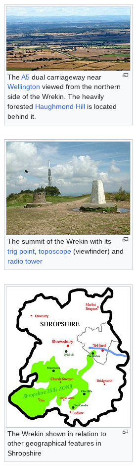
...a hill in east Shropshire, England. It is located some five miles (8 km) west of Telford, on the border between the unitary authorities of Shropshire and Telford and Wrekin.
Rising above the Shropshire Plain to a height of 407 metres (1,335 ft) above sea level, it is a prominent and well-known landmark, signalling the entrance to Shropshire for travellers westbound on the M54 motorway. The Wrekin is contained within the northern salient of the Shropshire Hills AONB. The hill is popular with walkers and tourists and offers good views of Shropshire. It can be seen well into Staffordshire and the Black Country, and even as far as the Beetham Tower in Manchester, Winter Hill in Lancashire and Cleeve Hill in Gloucestershire.
Name
The name of the hill is ancient, predating the Roman occupation. It is from the early British language, its name reconstructed as Wrikon or Uriconio. It is presumed to have given a name to the Roman town of Viroconium (in full Viroconium Cornoviorum or 'Viroconium of the Cornovii'), and hence to modern Wroxeter, Fortress by the Wrekin, which stands in that location. Some have connected the same name to another Cornovian town, Wrexham (named in a charter of 1236 as Wrectesham).
In English, the Mercian 'Tribal Hidage' includes an entry for the people recorded as 'Wocensæte, presumed to be in fact Wrocensæte, and in a charter of 855 found in the Worcester cartulary it is spelled Wreocensetun, meaning "Wrekin-dwellers", whose lands encompassed much of today's Shropshire, perhaps all of it. The kingdom of the Wreocensæte was a minor kingdom in the area under Mercian overlordship, and whether of English or British or mixed blood is unknown. It preserved however a much older name.
The hill has given a name to a geological type, the Uriconian series of rocks.
For several centuries the hill was known also as 'Mount Gilbert', a name given to it by the Normans after a hermit who lived there.
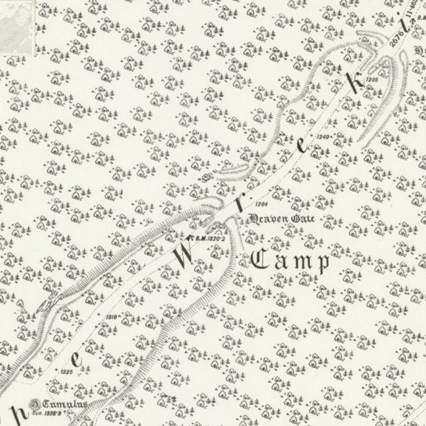
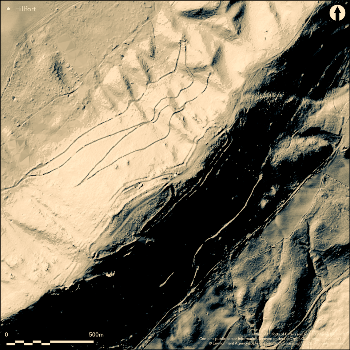
Summit
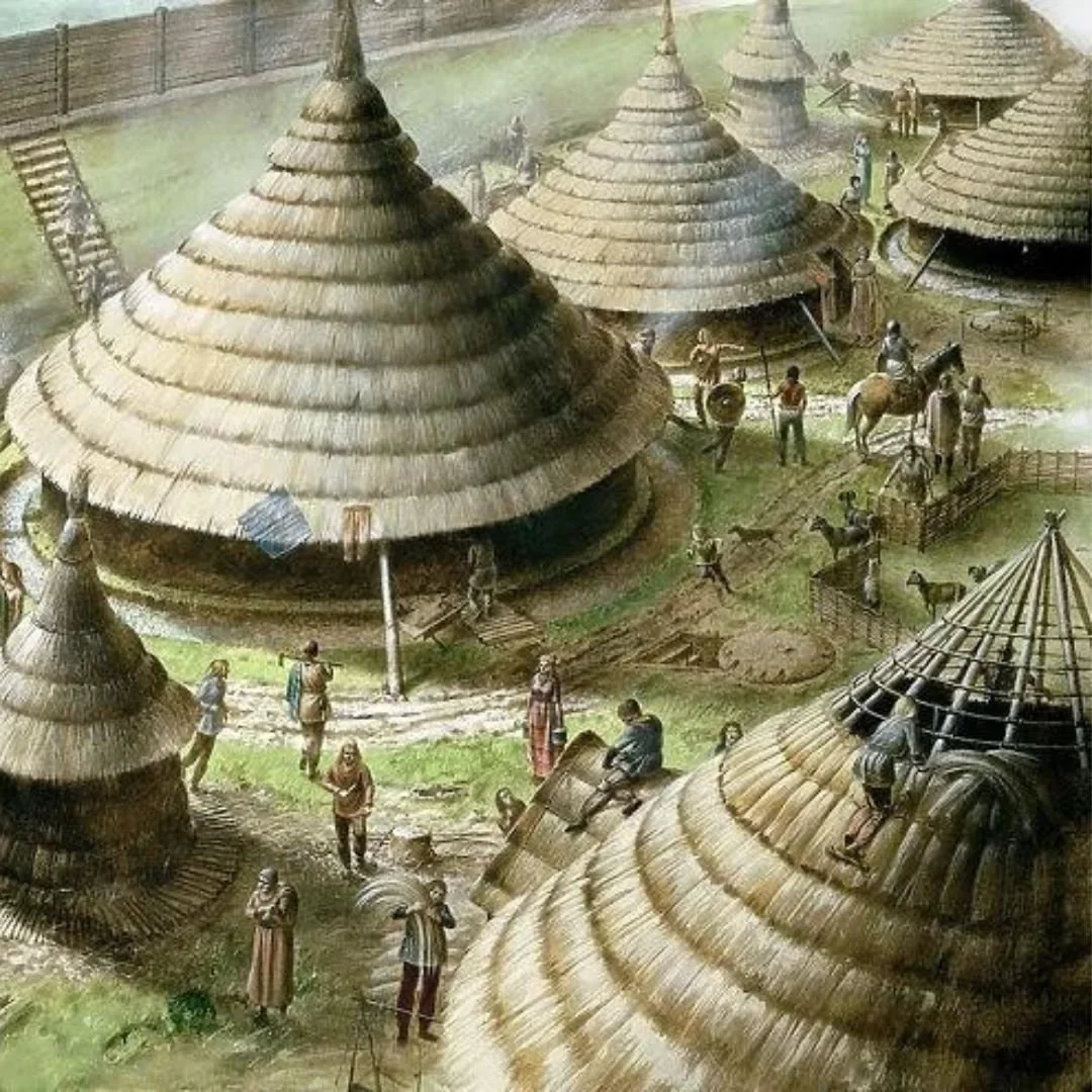
There is an Iron Age hill fort on the summit almost 8 ha (20 acres) in size, to which the name Uriconio originally referred. It is thought the fort was built by the Cornovii tribe and was once their capital. In AD 47 Roman legionaries stormed the fort and set fire to it, displacing the Cornovii elite into the surrounding landscape and building a signal station to communicate along Watling Street.
A more recent addition is the Wrekin transmitting station, used for broadcasting and telecommunications. At the top of the main mast is a beacon which emits a red pulse of light every few seconds at night. A beacon was originally erected on the Wrekin during the Second World War to warn aircraft, and was kept in operation until 1960. A new beacon was then installed in 2000, as part of a project to celebrate the new millennium. It is known locally as the "Wrekin Beacon", and is visible for many miles around.
The trig point and toposcope at the height of the summit was incorporated into an artwork, The Sky Begins at My Feet, which was designed by Wellington Arts Collective and unveiled in October 2022 in honour of the Platinum Jubilee of Elizabeth II. The sculpture is in the stoneware clay tiles laid around the plinths bearing relief portraits of seven local heroes and heroines by artist Sharon Griffin, and a range of decorative tiles designed by the public and various community groups and workshops.
The geology of the Wrekin and its immediate area is complex, consisting of a variety of rocks of a range of ages affected by numerous faults. The crest of the Wrekin's ridge and its northwestern slopes are formed from various rocks of volcanic origin assigned to the Uriconian series, of Precambrian age. The 'Uriconian Volcanics' include rhyolites, tuffs and agglomerates. These rocks – layers of ancient lava flows laid down in a volcanic island arc, similar to modern Japan – are approximately 680 million years old.
Dolerite dykes intruded the extrusive volcanic rocks around 563 million years ago. A variety of the intrusive igneous rock granophyre, known as Ercallite forms the northeastern shoulder of the Ercall. It was put in place around 560 million years ago and is overlain by Cambrian rocks of sedimentary origin. The southeastern side of the ridge is largely formed from sandstones and shales of Cambrian age. They include the early Cambrian Lower Comley Sandstone and Lower Comley Limestones together with the Wrekin Quartzite, outcrops of which also occur to the northwest of the ridge.
The lower ground to the northwest comprises sandstones and mudstones of late Carboniferous and Permian age whilst to the southeast are a succession of rocks of early Carboniferous age including limestone, the Little Wenlock Basalt and the Lydebrook Sandstone.
Structurally, the Wrekin together with the Ercall forms part of the Church Stretton Complex where different geological terranes meet. The Cymru terrane is to the west with the Wrekin terrane to the east of the fault system.[citation needed] The fault system trends north-northeast:south-southwest and the line carries on through other geologically important exposures such as those in the area of Caer Caradoc.
Contrary to a common misconception, the Wrekin has never been a volcano in its own right, but is composed mainly of volcanic rocks and is a product of volcanism. Its modern shape, which from certain viewpoints appears to resemble a volcano, has been formed by other natural processes.
________________________
The name the Wrekin is also used to refer more generally to the part of East Shropshire around the towns of Telford and Wellington, within sight of the hill. The surrounding area is one of the birthplaces of industry: Ironbridge Gorge is just to the south of the Wrekin hill. Woodland covers much of the hill, the area around the hill and into the Ironbridge Gorge area too. The eponymous Wrekin parliamentary constituency incorporates the hill.
Historical Insights
Take a journey into the past...
Short videos and animations reveal stories from ancient geology to contemporary life.
Expert Services
Freelance transcription, proofreading, subtitling, and video editing to meet your needs.
Get in touch
E-mail: chris@wrekinsets.co.uk
Address: 44 Park Street, Wellington, TF1 3AE, Shropshire, United Kingdom